For background information on this series, you can read:
Part One – Part Two – Part Three – Part Four
In part five of this series, I was to tackle the Thorsborne Trail on Hinchinbrook Island with my wife.
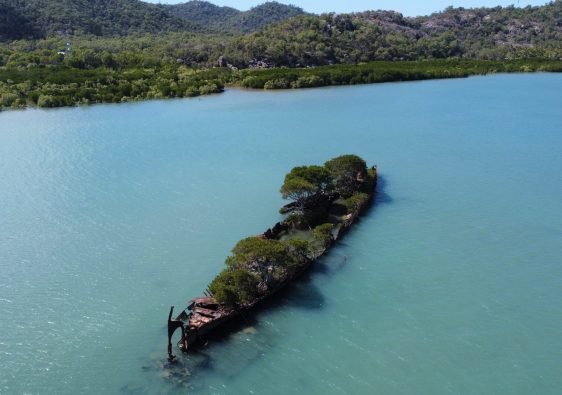
Hinchinbrook Island is within the Great Barrier Reef World Heritage Area and the trail was named after the late Arthur and Margaret Thorsborne. To help preserve the natural beauty, only 40 people are allowed on the island at a time with the largest group size being six. It is rated as one of the Top 10 Hikes in the World!
You can book your campsites here. Remember to get in touch with the NP if you want to ascend Mount Bowen. Helicopters fire bomb for back burning and you’d hate to be in the way!

Funnily enough, I had been watching the old TV series called “I Shouldn’t Be Alive” and an episode came on that was based in Australia. The story was about an adventurer named Warren Macdonald who went to Hinchinbrook Island (off the coast of Cardwell, QLD) to explore the highest peak – Mount Bowen (1,121m). In an unfortunate accident, deep within the mountain, a boulder crushed his lower half and resulted in him losing his legs. Believe it or not, it inspired me to do the Thorsborne Trail! Warren Macdonald is an even more inspiring adventurer today!
The problem is, this hiking trail is generally booked out for months at a time, and securing a spot when you need it is a challenge. So as we lapped Australia, I checked every couple of days, but by the time we reached Cardwell, no bookings had become available.
As we moved closer towards Cairns, we stopped at a camping spot on the grounds of a golf course and set up for the day. I don’t know what came over me, but I checked the National Park website – I couldn’t believe it! Two spots had opened up (I’m guessing because border closures meant someone had to cancel unfortunately).
I frantically explained the situation for my wife who was very hesitant. I had taken her on an overnight hike to Carnarvon Gorge, but taking on the Thorsborne Trail was next level. Without being too pushy (haha) I said we needed to decide ASAP. Reluctantly, she eventually agreed and I immediately made the bookings and also booked the boat transfers to and from. We used Absolute North Charters with skipper John – highly recommended. We also downloaded the “Thorsborne Trail” app for our phones which was based off his information – worth the $5.
It was on! We had a week to prepare and get everything ready – this was going to be a big step forward especially for my wife. Nerves were running high, especially when people told us there were crocodiles on the island and there were river crossings – but there was no pulling out now.
Day One
Campground – Lucinda – Boat Transfer – Ramsay Beach – Nina Bay – Little Ramsay Bay
We stayed at Mungalla Station near Forrest Beach for a couple of days before leaving and got our hiking bags sorted. John, from Absolute North Charters had informed us that everyone who was supposed to be going had to cancel (border closures, or at that time Cairns was in a three day lockdown?) but we assured him we were still good to go!
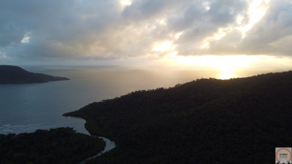
At 8am in Lucinda, we were off! And what a start it was… as it was only the two of us, we were on the company’s small boat – and it was a bumpy ride! The boat was a little uncomfortable and the jarring of our backs when the boat would go over the waves crest and crash down – wasn’t very pleasant. Plus it would sporadically rain on us haha.
John explained some of the islands history and told us about the time that he met Warren Macdonald and helped organize a reunion tour on the island. He had also had met someone who was born on the island many years ago – wow!

After a very bumpy boat ride, we finally reached the inlets of the mangroves, and it was smooth sailing all the way until we reached the small dock and the Ramsay Bay Boardwalk. As we unloaded, and John gave us the last few pointers, he turned the boat around and vanished behind the mangroves – reality kicked in!
After a quick bite to eat at the entrance to the beach, we set off on an adventure that would be a massive game changer for us.
We walked around 1km down the beach before we spotted the entrance to the trail. Walking in sand is an interesting thing when you’re loaded with hiking bags, it was already a learning curve trying to find a place to step where our feet wouldn’t sink in and waste energy. When we entered in the forest, it was probably at this point I felt the most nerves.
I’ll make a note about our bag weight at this point. I told my wife that this journey would be tough, and adding a few kilos wouldn’t make much difference. So I convinced her (and myself) that we would take a six pack of beer, two bottles of mine, ingredients for cheese and crackers and also a few other luxuries… it certainly added to the worth to and it DEFINITELY made the track more difficult. Unfortunately for me, a lot of the consumables were with my wife (her pack got lighter and lighter).


As we entered the forest, we were soon back out at a beach – Blacksand Beach. It was a small creek inlet and some shallow water. There were small fish swimming around also some mudskippers which were hilarious to watch.
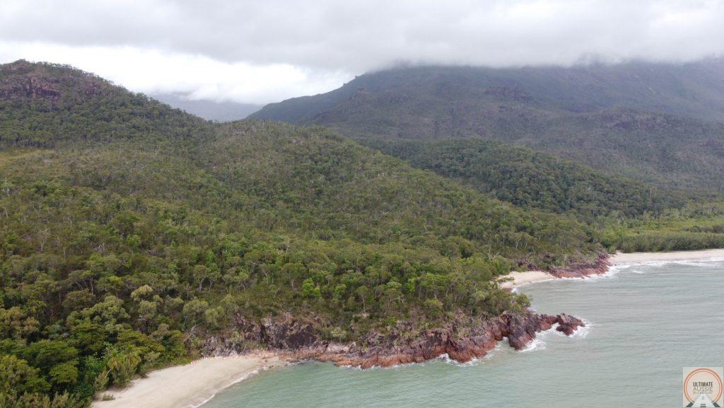
We kept hiking, and already the legs were burning. Being on Hinchinbrook Island, you release pretty quickly that no one is going to roll four the red carpet for you or make the track easier – it’s raw, natural and wild! That’s the beauty of it and we hope it stays that way.
Soon we reached a little clearing where the turn off for Nina Peak was. We dropped our packs, took our day bag and started the ascent. This was brutal! My wife made it about 1/3 of the way up and said she would wait for me, so I made my way up, taking breaks pretty often to catch my breath. I couldn’t imagine what it would be like if we kept our hiking packs on haha. Along the way there are some large boulders you can climb onto and enjoy the view of the coastline. It was so windy when I was up there, it was actually a struggle at times to stay balanced. You may get some phone reception up here.
As I descended Nina Peak, I met my wife at the half way point (she made it up a bit more) and we went back down together. It was basically downhill all the way to Nina Bay. Nina Bay has space for camping and some racks for hanging your bags, but we were planning on going to the next campsite, Little Ramsay Bay.


We did meet someone at Nina Bay, he was traveling solo and looked like he was taking his time on the island. Again it was a bit windy that day, so at one point seen him chasing his inflatable pillow down the beach as it blew away.
Plodding along the beach, we headed towards our campsite for the night. It was another 1km roughly down the beach – though this includes moments where we had to climb sections of rock and scrub. As we reached a bit of rocky headland, it was time to head into the forest again, as we tackled the last section of the day.
Again, we emerged onto a beach initially covered in rock and driftwood, then it was back onto the sand making the last few hundred meters a bit tougher.
Nina Bay is directly next to a creek where you can fill up with water, and rock hop to explore upstream. There wasn’t much water around in the rocky section of the creek when we were there, but a few sections of some nice clear water.
Once set up for the night at the campsite, we had dinner and went to bed pretty early with the sound of the waves crashing onto the shore. It was such an exciting adventure, but we were really stuffed! The price we pay for packing luxuries!


Day Two
Little Ramsay Bay – Banksia Bay – Blue Lagoon – Zoe Bay – Zoe Falls – Zoe Bay
Other than having some pretty heavy packs, things were going pretty smoothly. For me this was odd, because the few hikes that I had done so far, something ALWAYS happened haha. So it was off down the beach again in the morning until we reached a turn off that led us into the scrub.
A side trip on the way is called Banksia Bay. It’s not too far out of the way and worth a look – even if you drop your pack at the junction and head down there with a day pack. There’s a bit of exploring to be done at both headlands of the beach. You’ll spot some sections of reef as well from here.
We knew the journey to Zoe Bay (our next campsite) would be tough, so we kept moving. The track heads up hill a bit for a while as you walk in between two hills, then heads downhill the closer you get to the river. It’s actually in this section that there is a new section of path due to a landslide damage the old section of the track. It’s only for roughly 150m or so, then it joins on with the original track.
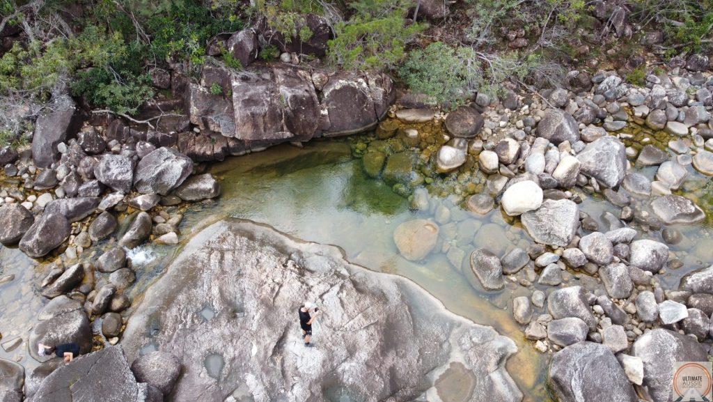
At Cyprus Pine Creek there is a beautiful swimming hole called the Blue Lagoon, and if you’re feeling like exploring a bit more, one of the creeks that feed this can be followed upstream for 40 minutes or so to reveal a beautiful waterfall – if there has been enough rain, it will have a mini infinity edge. We made some friends with some little fish that were somehow comfortable swimming with us!

After a bit more hiking, we reached Zoe Bay. What a relief! It was such an amazing day with the constant variety in landscape and the refreshing swim, but we were both stuffed.
As we arrived at Zoe Bay, we were astounded with the beauty of the place. It’s such a great campsite with the river inlet right next to us. We met some other people that day – a guy hiking by himself, and then another couple from France who introduced themselves. They camped right next to us (there’s heaps of campsites to choose from), but they told me they were worried about the crocodiles – so I now understood why haha.
Although it had been a big day, we knew Zoe Falls was close and we heard it was nice. So grabbing the day bag, I stuffed the drone, camera, a bottle of wine, cheese and crackers, and we headed to the Falls. It was an easy walk with bit of rock hopping – but we are SO GLAD we did it – Zoe Falls to this day remains our favourite waterfall that we have seen. The whole experience was incredible!
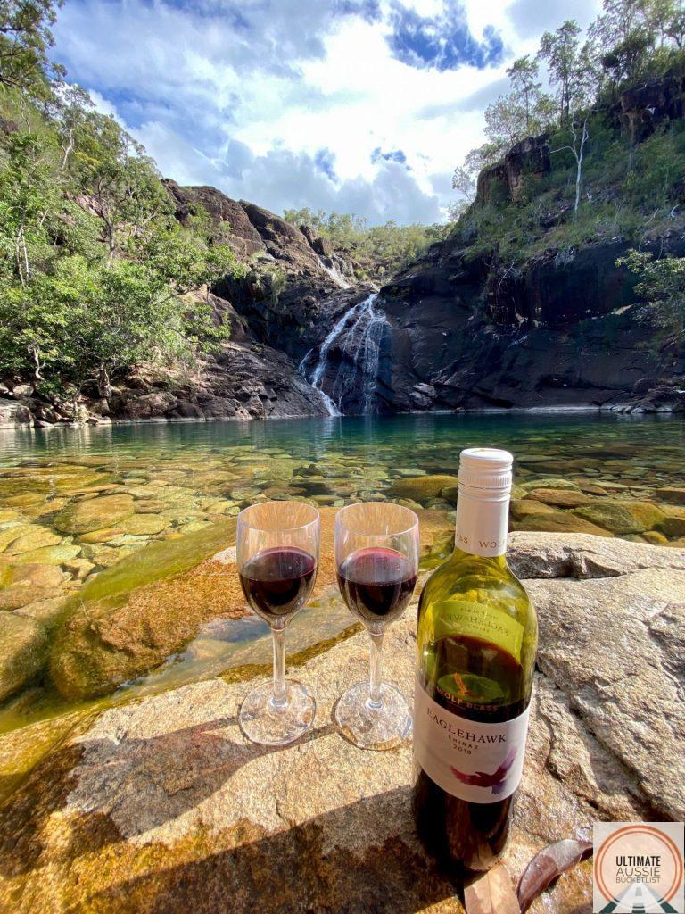
Upon reaching the base of the falls, we soaked in the beauty and then took some photos. There are a couple of good rocks to sit on, so we got out the wine, cheese and crackers, and enjoyed a couple of hours there. It was truly incredible, and it’s a moment we’ll never forget – complete magic.
While we were there eating our snacks, it seemed like the fish from the base of the falls were swimming around us, waiting to be fed – we were too hungry to share haha. But both my wife and I put our fingers into the water to tease them – and both got bitten! It was a bit of a fright, but pretty harmless!
It started to get a little dark, so we headed back to the Zoe Bay campsite and settled in for the night.


Day Three
Zoe Bay – Zoe Falls – Sunken Reef Bay – Diamantina Creek – Mulligan Falls – George Point
If you’ve read the previous parts on this series, you’ll be thinking that this is hike seems pretty straightforward this time – no dramas! Well at this point, except for my overloaded pack, things were going just dandy. I was in love with the island!
As a side note, didn’t spot any crocodiles – but there were occasional warning signs at some creeks. Lucky for us, the swampy areas were mostly mud or shallow water – but I could imagine it would be pretty nerve-racking if you had to wade through water.
Introducing: big problem…
This is an unfortunate habit of mine that I’m trying to break – taking my contact lenses out before I go to bed. I’m fairly new to them, so I forget very easily and usually end up taking them out the next day. This was one of those days. In the morning, we had planned on getting up to the top of Zoe Falls for the sunrise – so I was in a rush. My contact lenses were still in and as I lay there trying to get them out (getting frustrated) I accidentally scratched my own eye – silly, I know!
It was pretty damn uncomfortable to say the least. My eyes wouldn’t stop watering and there was a little bit of pain involved with it… I couldn’t believe it! The hike was going so well – especially compared to the other one haha.
There was nothing I could do, but keep moving. We packed up and hiked for about 1km until the base of the falls. The ascent is pretty tough going and the track is pretty rough, but we made it up with head torches and started to set up breakfast on the rocks. The sun was coming up shortly, so we made a coffee to enjoy the moment.

It was awesome! It was just the two of us, the water was flowing nicely, and there was even some natural “cup holders” up on the rocks. We watched he sun come up as we drank our hot coffees and ate a warm breakfast. Just to make the occasion special, we even had a glass of wine each – naughty, we know haha.
We jumped in the water at the top of the falls and soaked in the view from the infinity edge. There were a heap of little curious yabbys in that section – but quite small so harmless.
Zoe Falls will always be one of the highlights of our travels in Australia. It’s so unique, and the journey that it takes to get there, makes it even more special. You can reach Zoe Falls with day trips and the short 1km walk, but it cannot be truly appreciated without the combination of taking on the Thorsborne Trail.


There was still the problem with my eye… and it wasn’t going away.
The hike followed the river for quite a while, and with a scratched eye, tears were being produced, making it hard to see properly – I had some close calls while rock hopping! Doing it with an overloaded pack just adds to the issue. I was still enjoying the hike so much, but the situation was a bit trickier because of the scratch.
Not far before Mulligan Falls and the campsite, there is a turn off to Sunken Reef Bay. Around this junction there will be some clearings on the hill where you can get phone reception. We see some form of a weather station there as well.
Continuing on, we reached Diamantina Creek and had a refreshing swim there. The rocks were quite slippery around the swimming hole, so getting back out was a bit of a mission – it would have been funny to watch.
The landscape and scenery of the Thorsborne Trail always amazed me, I began to see why it was rated so highly, and why they try to preserve the trail by allowing a restricted number of people on it.
It was around this area that we came around a corner, and a very large black snake was sunning itself on a rock. When we came into view, both us and the snake had a n absolute fright haha, luckily it slithered away really fast!
By this time, my eye was only getting more irritated and agitated, but I knew there was nothing I could really do! At around 1pm, we reached Mulligan Falls and had some more wine, cheese and crackers. We enjoy these little luxuries when we hike, even if it means adding weight to our bags. There was some warning signs about swimming there, so we decided not to.

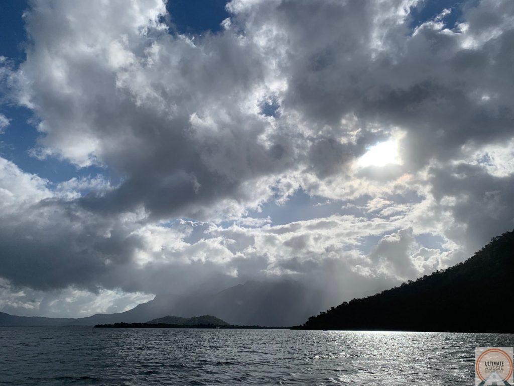
As we got a little phone reception, we checked the weather – and guess what… we were in for some rain and serious wind! Then my wife suggested that since it was still pretty early in the afternoon, we should make a break for George Point – the final camping spot and place that we would get picked up the following day. I hesitated a bit, but knew it was a smart choice – especially if we got rained on! Plus, the tide would work perfectly for our creek crossing (shin deep).
So off we went! We moved pretty quickly thought the forest and track. At one point we walked through a section that had been completely decimated by wild pigs – it was truly shocking. I had noticed it was a bit of a trend on the different hikes we had done, hopefully the situation can improve before they do irreparable damage.
We made it to Mulligan Bay. By this point, my eyes were watering like crazy, and the wind was only making it worse. There were moments that I had thoughts that hiking mustn’t be for me – something goes wrong every time I leave the front door haha. But, it looked like we had a long walk up the beach – about 6kms including one inlet crossing.
This part was definitely a challenge, we ended up walking with our reef shoes ever since we crossed a creek inlet, and constantly looked for the best parts to walk on, soft sand destroys the energy supply really fast. We got ally excited about half way along the beach because my wife spotted an echidna looking for food – it definitely gave us a mental boost to finish the last couple of kms.

Finally, we reached George Point and found no one else there. It was still very windy at this point, so we had to set up a tarp of the camping sign to block the wind – we pitched our tent behind this and it worked a treat.
My eye was completely red at this point and the pain was kicking in. Most of the time I had to keep my eyes shut… and they became really sensitive to the light. My wife created an eye patch for me with the first aid kit we have with us. It wasn’t pretty, but it worked and took some of the strain off. It was very uncomfortable the whole night and I didn’t sleep much because of it – but I’m glad we did the extra work to get to George Point because it did rain!


Day Four
George Point – Lucinda – Doctors
Today was the day we were scheduled to get picked up. A couple of people also made it to George Point and said they had got soaked – again, we were thankful that we stayed dry!
It was a pretty boring morning waiting for our boat to pick us up. It was only a 10 minute trip on the boat to Lucinda, and in hindsight, we should have called and asked for an earlier pick up – we were the only ones he needed to pick up. My eye was still problematic, and the sensibility to light was pretty bad. Getting used to wearing an eye patch was another struggle in itself haha.
Finally, we were picked up and taken back to the dock. It was a short walk to our campervan where we discovered another problem – there was a small bag of rubbish that we had forgotten to take out before we left… we were greeted with the sickening sight and smell of flies and maggots in our van… gross!

John, from Absolute North Charters had recommended a place for lunch and was even nice enough to order ahead for us as the kitchen was shutting very soon. This was our saving grace because cleaning the van out properly took us a while. We were petty exhausted from the few days of hiking, so I think we were both too tired to get upset about the rubbish we left there.
Now it was time to get to the doctors – something had to be done about my eye. Thankfully we found one that was open and would see my straight away. After some back and forth, the doctor spoke to the closest hospital that had an eye specialist – he said that I might have to go there… we weren’t too keen on the idea. As much as it hurt, I was pretty exhausted from the hike and lack of sleep the night before. Thankfully the doctor and hospital spoke and we were given some advice and special eye cream and drops to help with the recovery process.
After a quick trip to the shopping center at Cardwell, we took off to the caravan park nearby and began out process of recovery.
It was still an amazing trip, and in reality, the scratch on my eye didn’t make me enjoy the place any less. It taught me about dealing with the pain and also reliance upon my wife to help me through. I was just glad that within a week, my eye was all good!

Lessons from Hinchinbrook Island:
- Pack light, but don’t be afraid of some luxuries.
- It is never too early for a glass of wine when you’re hiking.
- Never take your eyes for granted. If you’re walking around sticks and branches, wear some glasses.
- Take reef shoes or crocs to the Thorsborne Trail.
- Plan creek crossings with low tide, or mid tide.
- When hiking, don’t forget to look around every now and then and enjoy the scenery.
- Have solid ankle support when rock hopping with a hiking pack.
- Ask advice to those who know the hikes the best – get local insight too.
- Take time to enjoy the sunrise and sunset when you’re hiking.
- When walking on sand, keep to the places that you won’t sink in too much.