For background information on this series, you can read:
July 2021
After completing the challenging Carnarvon Gorge Great Walk, I was feeling pretty confident and sure of my hiking habilities… but there’s still more that I needed to learn.
Introducing: Paluma Range National Park.

There’s a reason why I’ve created a series even though I call this an “introduction” to the hiking world – it takes a set of experiences to call yourself a hiker – and I didn’t really see myself as one until the end of the journey in the final part of this series.
In this part of my hiking journey, I was introduced to the beautifully diverse, but underrated Paluma Range National Park. My wife and I went there in the last week of July for a couple of days before our trip to Magnetic Island. We did a couple of small hikes (after the long, windy drive up to Little Crystal Creek and Paluma Dam), and it was stunning! Birthday Creek Falls, Ethel Creek Falls, Paluma Village, Cloudy Creek Falls and Little Crystal Creek Falls were all amazing. I loved it and suggested we come back after Magnetic Island.

While away for a few days, I had got in touch with the Townsville Bushwalking Club and inquired on some hiking trails at Paluma NP and some suggestions – and even the possibility of joining them. No walks were planned on the days we would be back there, so I decided I’d do my own exploration. We were exhausted after a lot of snorkeling and hiking on Magnetic Island, so we were going to have a rest day… I had other plans – I would go and check out a few hiking trails.
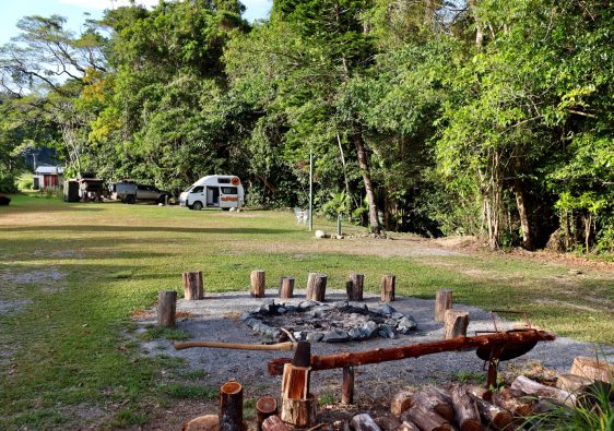
At 6:30am, I was off. We were staying at the Big Crystal Creek campgrounds, and there was a trail off the road that led to the rock slides – that was where my adventure would begin.
Within a couple of hundred meters, I reached the first rocky creek crossing – luckily at this point I had installed AllTrails as I couldn’t find the trail on the other side for a while haha. Already I had my doubts at this point and was wondering what I got myself into.
After passing an old abandoned hut, the trail (goat trails) headed deep into the National Park and crossed an occasional creek – which were all flowing quite nicely. The trail that I was following was called Bullocky Tom’s. The trail just kept going up – I was stopping pretty frequently trying to rest my legs… a couple of times tempted to turn around because I knew it just get going up haha.


My first stop was Bullocky Tom’s Lookout at around 580m elevation (I had started at around 50m at the campsite). It was a nice view over the range and I had some company of some beautiful birds while I ate my snacks. I didn’t really have a plan for the day, I was just curious because I had heard the whole area was an old mining hub and was scattered with remote but beautiful waterfalls.
At this point I was wondering why my feet were hurting so much… silly me! I had put on my good hiking shoes, but had left my really bad ankle socks on – the blisters had already formed and my heels were a bit raw. Stubborn as always, I just told myself it would be okay haha.
Onwards! The next stop would be Gold Creek Falls – at around 770m elevation. Again it was up and up and up. Along this way I had run into two black snakes – one I had almost stepped on because I wasn’t paying attention, least to say it wasn’t too pleased about that.


Finally reaching Gold Creek Falls, there was a rope to climb down and a log to cross to reach the top. There’s also a perfect swimming hole at the top which was FREEZING! I knew the chances of seeing someone out here was low so I stripped down naked and jumped in for a refreshing dip. It was magical – I could have easily stayed there all day.
For some of the hard sections, I had music playing on my phone to pump me up – I had packed my power bank for a charge. I got the cable out and the power bank… ahhh crap! I had brought the wrong cable! My phone was at 50% and I needed it for the rest of the journey. Just great!

It was time to keep going – I could tell already that if I kept following these tracks, it would be a full day adventure. Next was junction that took me to Crystal Creek Falls – these were really nice and untouched – but knowing the day that lay ahead, I had a look, backtracked to the junction and kept heading up hill until Johnstone’s Clearing. It would have been a good option for camping if it was a multi-day hike.
I noticed on the map there were some trails heading to some old signs of mining life. One was just a creek with a little swimming hole (supposedly this was a bathing spot for the old miners) and then another creek that had short hand dug tunnels along the banks. I almost got myself lost on one of these side trails because it was overgrown and rarely used.

From the clearing I headed up again and discovered the network of trails that surrounded the DCK Shelter. The DCK Shelter is actually private property in the heart of the National Park which can be booked for camping. Next to a beautiful flowing creek, the shelter has toilets and water, as well as a few spots for camping – it was one of the most incredible things I had ever seen. From what I could tell, it was built in dedication to a family member who had lost their life in the forest. I paid my respects and thought deeply about life while I snacked on some Nutella (I didn’t pack much food for the day).
Nearby was a side trip called the Wine Cellar. As you climb a goat track, there’s a rope tied to a tree which you descend 10 meters or so onto a creek bed. Close by is a hand excavated tunnel in the creek walls – here you’ll find some old bottle and an old lantern as well as some cute micro bats! It’s only a short tunnel, but it was an awesome site!


Nearby, you’ll also find some remnants of old hand tools that the miners used to work with. The whole experience so far was pretty spectacular! Don’t get me wrong though, my legs were hurting from the hike up, and time was passing pretty fast. I knew I had to move along for the next parts of the trail. I also came across some old abandoned mine shafts and tunnels nearby – these are barricaded off for safety reasons – thankfully! There looked like there was an entrance further up the track, but it looked very unsafe and thankfully common sense prevailed – I moved on.
Heading North-West along a trail, I reached place called Buttercup Lookout, which had some nice views, but was obstructed a bit by trees and bush. After a short break and a text to my wife (I had phone reception at a few of the lookouts along the way), I continued up until reaching the summit (I think?) of Mount Spec. It stands at roughly 1000m above sea level. Researching at a later time, I found out that it was the second highest peak in the National Park. Accessing this peak is possible from tracks that start at Paluma Dam.
Next came the descent along Foxlee’s Track. This headed directly West from where I was. The hike had been really enjoyable so far, despite how much my legs were hurting after the ascent up to Mount Spec. And now it was all pretty much downhill. Along this track I did stumble on to another two black snakes – thankfully they left pretty pretty when I made some noise.


There wasn’t too much to see heading down this track other than Foxlee’s Lookout. This was an arming view of a long expanse of coastline – definitely a perfect spot for a rest and some phone reception.
I was down to 20% on my phone, so I let my wife know I had survived the intense parts of the hike and that it was all pretty straight forward from here haha. Meanwhile, at the campsite, my wife had enjoyed a leisurely swim and was doing her nails haha.
The downhill was pretty intense in some sections – my knees were giving me some strife and I was hungry and thirsty at this point (the last chance I could fill up water was the DCK Shelter creek wth my Lifestraw bottle). Along this section I had run into a “wait a while” and it hooked onto my face as I walked into it – leaving a nice cut up the side of my face. I think the fatigue and worry about dusk approaching had my focus all out of whack.
But silly me… I realised that this trail was not a loop! I was so focused on making it section to section that I had failed to look at the big picture haha. Going down Foxlee’s Track meant that I would come out to a road that was north of the campsite – I would have to follow the road.

Making it near the bottom, I had reached an old logging road or an old 4WD track – and within fifty meters, I was met by a large snake sunbaking in the middle of the track. It was a python so I didn’t expect much drama, but it coiled up and tried to strike me! It was aggressive and maintained its coiled position with its head raised so I backed up until it decided to leave.
Walking along for a while, I came out of the forest and into a clearing – it looked like the back of a mago tree farm. Sticking to the outside of the property, I was a bit nervous because it was a hot day and the grass was a bit long for my comfort. On a few occasions I heard snakes but didn’t see anything… until…
Nearing a creek that passed through the property, I heard the grass rustle and something was moving towards me very fast, then all of a sudden this large snake raised its head up in the air and stared me down from about four or five meters away – this scared the living daylights out of me, so I stood still and we both stared at each other motionless. This was a big snake – I couldn’t tell what type it was because it wasn’t a black snake. I wonder now if it was a brown or tapian? I’d never had a snake actually charge at me before like this one.
Finally the snake slithered off into the long grass, so I decided I needed to get out of there. I crossed the creek quickly and continued through the grass until FINALLY a gravel road appeared. It was a relief to get out of the grass and inclines and declines of the range, but I was still way to far away from the campsite and it was now about 3:30pm. With only 3% percent left on my phone battery, I checked how far it was from this point to the campsite… 10km (including a 1km down the Bruce Highway).

I kept walking down the gravel road and eventually it turned into a sealed road. Passing some pumpkin and pineapple farms, I reached a bridge with a nice creek running under it – water! It was time for a big drink to rehydrate. I was quite parched at this point.
A bit more walking had me reach the Bruce Highway. Lucky for me, a petrol station was on the other side of the highway, so once it was clear, I made the dash for it. After smashing some Gatorades, I then thought about the walk back to the campsite… but it was still 7km away! And the sun was starting to set… what to do…?
It was only a small petrol station, but occasionally people would come, so I started asking people if they would be willing to take me to the turn off to the campsite – it was less than one kilometer. As you would expect, most people would be hesitant… and I don’t blame them. I looked like an absolute mess from sweating and bushbashing all day, plus I had blood on my face from the “wait a while” cut earlier.
Eventually a nice guy and his friend said they’ll take me. The reason why I didn’t just walk down the highway was the fact that there was a bridge on the way and no space for walking safely… being a busy time of the day – there was too much traffic for me to try to make a dash for it.
When we reached the turn off, the guy just offered to take me all the way to the campsite. I was so embarrassed but had to take him up on the offer otherwise I’d probably reach there after dark and I was so exhausted. What a legend!
I arrived back to my campsite and found my wife – she had no idea of the adventure I had just experienced. Stuffed, I collapsed in the chair and began to tell her all about my day.
Paluma Range National Park is stunning! I think it must be so underrated because we only stumbled upon it by chance. Little Crystal Creek and Big Crystal Creek are popular with the tourists, but he real gems lay hidden within the range – you really should go for an explore!

As with the previous hikes of mine, it turned into an adventure.
It was over 11 hours by the time I left and by the time I had arrived…
I had clocked in over 30kms…
I had some pretty serious blisters…
Most of the hike, my staple diet was a jar of Nutella…
I’ve also learned a lot from this hike.
Lessons from Paluma Range National Park:
- Good shoes are important but so are good socks.
- Check out your hike ahead of time and see if it is a loop or one way.
- Every now and then explore the path less trodden. You’ll find some National Parks will have a network of trails that aren’t used as much.
- Do not take chances with snakes – be snake savvy.
- Go over what you have packed before you leave. Pack enough food, water and the right cables if you need to charge devices.
- A back up hard copy map is a good idea.
- Take the opportunity for a refreshing dip whenever you can.