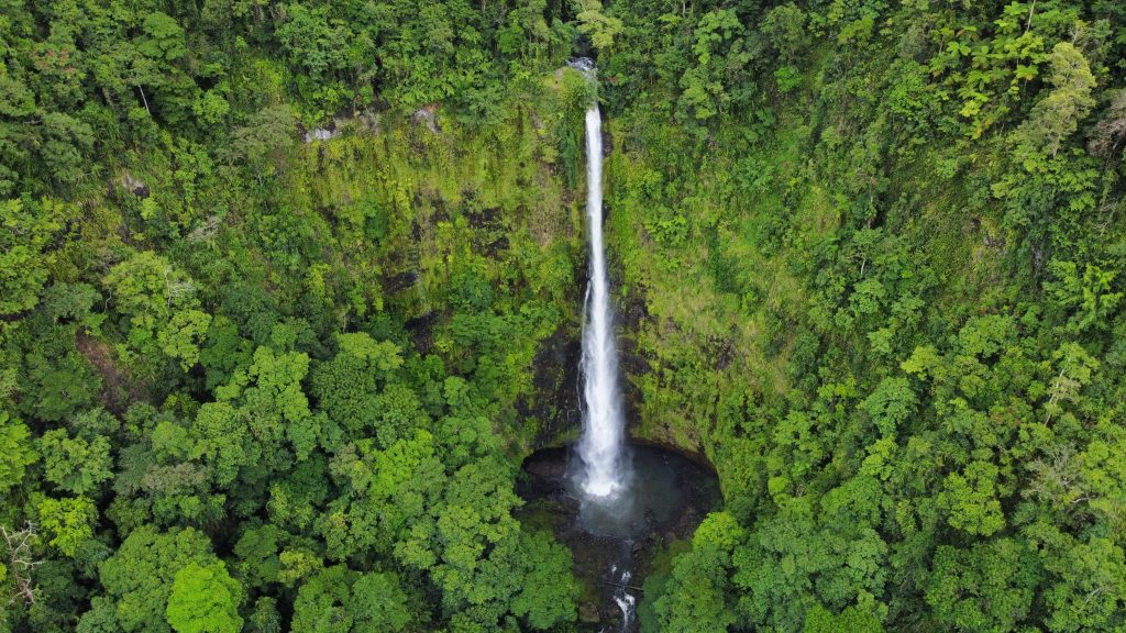
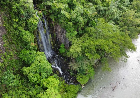
Cowley Falls in Far North Queensland is jaw-droppingly incredible! The surrounding landscape and untouched serenity will make you feel as if you never want to see civilisation again. It seems to have been lost and forgotten…
In our opinion, Cowley Falls is one of the most beautiful waterfalls in Queensland.
Where and How to Get There
Cowley Falls is just off the Palmerston Highway that runs from Innisfail to Milla Milla. Just east of Mamu Tropical Skywalk is a dirt road that veers off the main highway (southern side). It borders the Tea Plantation. There is a council gravel storage pit that you can park in front of.
Park here: -17.62605676818034, 145.81239285240534
Track start: -17.625893068395733, 145.8097763221522 (at the end of the piles of gravel)
Waterfall: -17.630286377764147, 145.80607515950592
Top of the falls: approx 2.5km return (advanced)
Bottom of the falls: 26km return (advanced, off-track)
Ultimate Aussie Bucketlist Experience
Please note: If you’re not paying attention – it can be easy to become disorientated on this short trip. I don’t believe it’s an official track – you’ll be relying on sporadic pieces of flagging tape on trees. Many trees have fallen and you’ll need to navigate around. Also, crossing the creek to get to the viewing area can be dangerous if the water is flowing. Please exercise caution – especially when getting to the ledge. There’s no question at all that if someone were to fall from there, it would be fatal. The best view (without a drone) is from the bottom – but it’s quite difficult to reach.
This was one of the last waterfalls I wanted to visit during our time in Far North Queensland. In all honesty, I didn’t know what the waterfall looked like or how to get there haha. There was a distinct sign of a waterfall as I scoured Google Maps (satellite images)… it was so close to the highway, I thought to myself – “if there isn’t a track, it isn’t too far to just navigate down to the river.”
I even convinced my wife to join me 😀

The journey begins! We cross the piles of gravel looking for an entrance… but the grass was so long and the treeline was so thick. We decided to walk to the far end of the gravel piles and then enter there – soon enough we saw signs of flagging tape and spray paint markings.
As there had been a couple of storms recently and heavy winds, there were some trees down and wait-a-while surrounded sections of the path. At some points, it was necessary to make our own way around until we found the flagging tape. The first half of the track was pretty flat and then it gradually got steeper and steeper as we descended toward the creek.
It was at this point that the track became a bit easier to navigate.
Of course we battled a few leeches, but thankfully it was no where near as bad as some other hikes we have done!
We were surprised to see remnants of stone steps during certain sections. Was this once a proper maintained track? I wouldn’t be surprised if it became “lost” due to the safety issue.
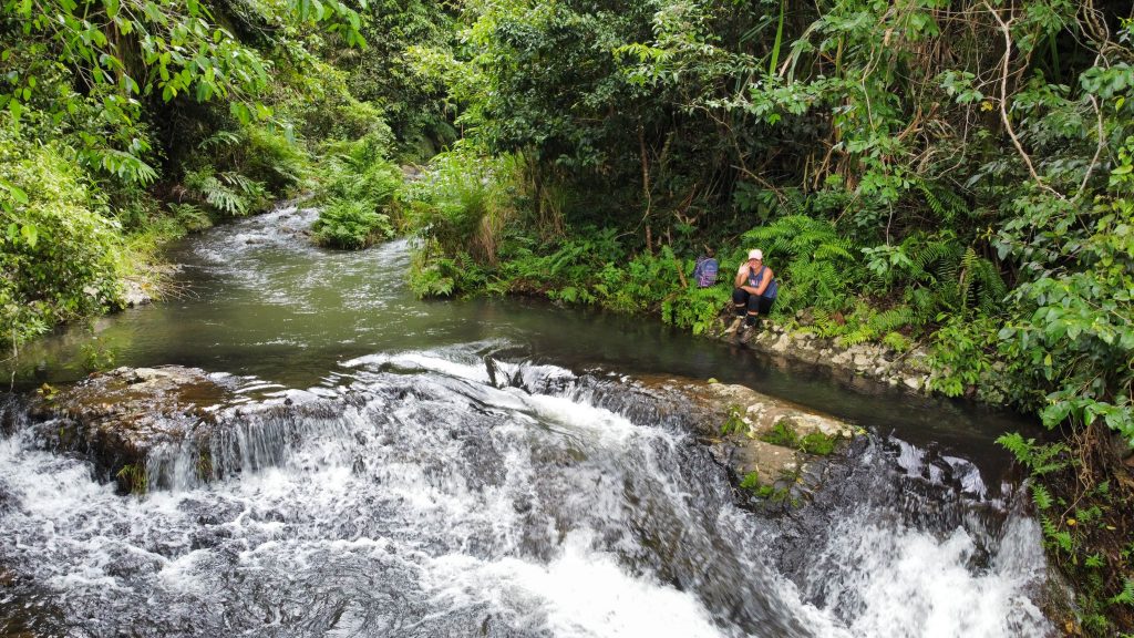
The descent to the creek can be slippery in places but we managed to get down without any problems. The creek was beautiful and it was almost tempting to jump in. The current was quite strong after the recent rain, so we just decided to follow a very rough path that runs parallel to the creek until we reached the top of the waterfall.
The track ends when the cliff edges begin. Here just pop down into the creek and you’ll find yourself at the waterfall. Unless it is safe to cross the creek – or you do it further upstream, there won’t be a view of the waterfall…
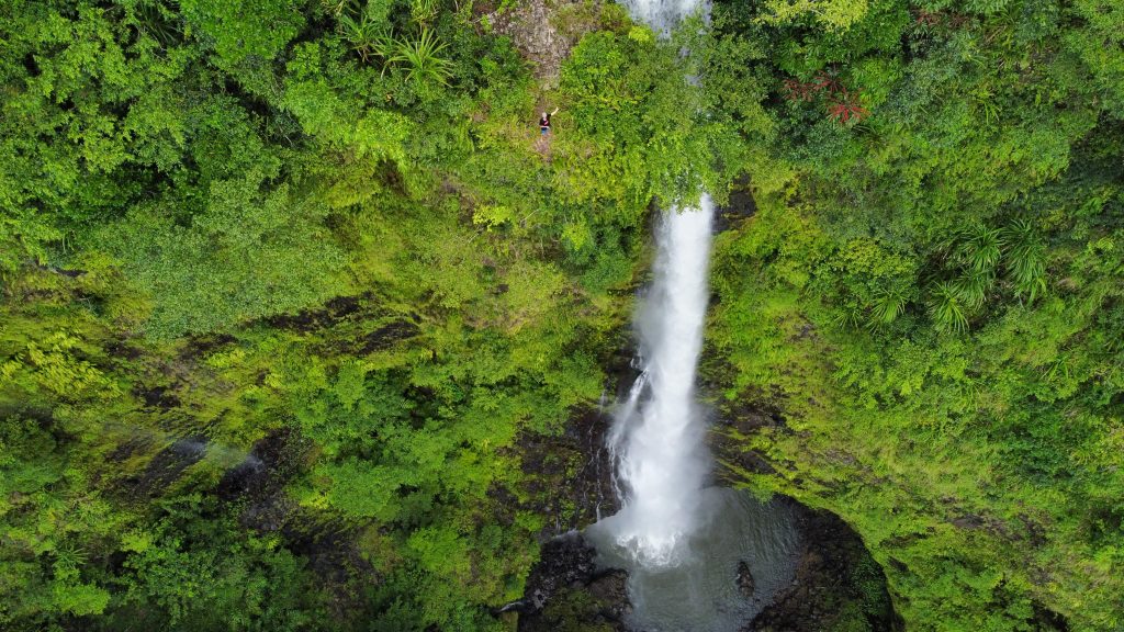
The opposite side of the creek provides a rocky ledge on which you can climb up and fully enjoy the view of the mountains and valley below. It’s an incredible sight and makes the adventure there all worthwhile. Carefully, you can stand right at the ledge and soak in the beauty of it all! This is where having a drone is handy – because without it, the view is hard to comprehend.
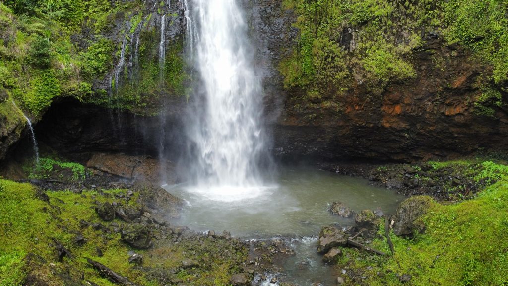
If you’ve got a full day and have proven experience navigating off-track, the trip to the bottom of the falls will provide you with a mind-blowing experience! There is a “cave” in which you can explore behind the waterfall.
Be sure to add Cowley Falls to your #ultimateaussiebucketlist
Our website is supported by our users. We sometimes earn a very small amount when you click through the affiliate links on our website – of course – at no extra cost to you 🙂 This helps us maintain the website and associated costs. Thank you!
Camera Gear:
- Camera: Canon DSLR EOS 200D Mark II, Black
- Long Lense: Canon 55-200mm Lense
- Camera Bag: Vanguard Camera Bag
- Tripod: Vanguard Veo 2 235ABM
- Memory Cards: SanDisk 64GB Extreme Pro
- GoPro: GoPro 9 Bundle
Drone Gear:
- Drone: DJI Mavic Mini
- Memory Cards: SanDisk 64GB Extreme Pro
What we use and recommend!
Hiking/Camping Gear:
- Tent: Pro Hiker 2
- Sleeping Bag: Black Wolf
- Hiking Stove: Jetboil
- Water Bottle: Lifestraw
- Hiking Bag: Black Wolf 70L with Day Bag
- Womens Boots: Oboz Sapphire
- Mens Boots: Salomon Ultra 4



great read about the falls and great to learn soemthing new in my backyard!! You have made it easier for us all!!! Sure Dan loved those leeches..hahahaa
Haha – you know she loved it! Hope you get the chance to go there mate, you’ll be blown away 😀
26km to bottom? Did u walk up the South Johnstone river from bottom?
Hi! If you don’t want to take the route from the top to the falls down to the bottom (sketchy in sections), it can be accessed from the South Johnstone Camping Area. Makes for a good overnight/multi-night trip.